Geospatial World Forum, which has been held in different countries every year since 2011, was held in Hyderabad, India on January 15-19, 2018, with the participation of around a thousand institutions and organizations from 70 countries.
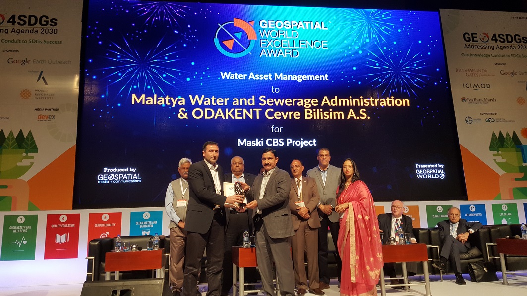
In the program organized by Malatya Metropolitan Municipality Water and Sewerage Administration (MASKİ) General Directorate, Geospatial World Forum, MASKİ GIS Project received an excellence award in the field of 'Geographical Information System in Water Management'.
Different and unique geographic information systems projects from around the world can apply as candidates to the Geospatial World Awards, which aims to introduce exemplary applications and innovations in the Geospatial sector, and which is internationally recognized and attracts the most participants in the sector.
MASKİ General Directorate, which is a candidate for Geospatial World Awards in the field of 'Geographic Information System in Water Management', was entitled to receive an excellence award with its MASKİ GIS Project in the program held in India.
With the project, many attribute information such as the location, status, capacity and efficiency of the infrastructures and superstructures of the institution are kept and many analysis opportunities are offered to the users. The application, developed with open source software infrastructure, serves users on web, desktop and mobile platforms.
The Geospatial World Forum (GWF) is an international geographic information systems event that highlights the value and power of geospatial information technology as an enabler on global economic and socio-economic issues. It is one of the 'must attend' events for geographic information systems professionals, featuring large-scale conferences and exhibitions, world-class speakers, major industry organisations, high-level discussion programs and a variety of social networking events.
Geospatial World Awards, 2007'de başlayan Coğrafi Bilgi Sistemleri (Geospatial) sektöründeki örnek uygulamaları ve yenilikleri tanıtmayı amaçlayan, uluslararası çapta kabul görmüş, sektörel olarak en fazla katılımcıyı toplayan özel bir ödüldür.
Geospatial World Awards is a special award that aims to introduce exemplary applications and innovations in the Geospatial sector, which started in 2007, and that attracts the largest number of participants in the sector.
Different and unique geographic information systems projects around the world apply as candidates to these prestigious awards.
There are three different award categories for the Geospatial World Awards, these are:
1. Geospatial Application Excellence Awards:
[Water Resources Management, Agriculture, Smart Cities, Transport Infrastructure, Location Intelligence, Land Administration, Defense and National Security, Health, Energy Resources Management]
2. Geospatial Technology Innovation Awards:
[Remote Sensing, Photogrammetry, LiDAR, 3D Modeling, Web GIS, Mobile mapping, Enterprise GIS, Topographic surveying tools, GIS stock images, Artificial Intelligence, Internet of Things, Autonomous Tools, Digital Cartography, e-Commerce, Cloud, Big Data Analytics, Closed Mapping etc.]
3. Geospatial Policy Implementation Awards:
[Policy makers and practitioners whose work directly influences the development of geoscience, technology, and innovation]